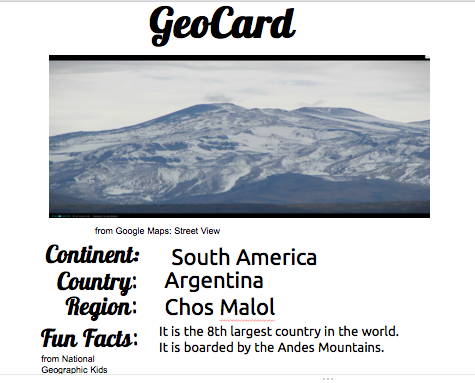
For the past few weeks, fourth graders have been making GeoCard trading cards about some region in the world. We are doing this as part of a collaborative year-long theme on continents at Myron J. Francis. Students were given a region to study in groups. We started with exploring in an atlas and globe. Next, they explored their region on Google Street View and chose a scene that best represents their area. Using National Geographic Kids country section (and Fact Monster for Antarctica) students chose a few fun facts about their areas. Finally, using Google Presentation (Google's version of PowerPoint), they created GeoCards to gather their information in a visually pleasing way. At the end of the unit, students were given two color-printed cards to trade with their classmates. There was a frenzy of excitement as trading began. The most popular cards were Rajadamnern Road, Thailand & Paris, France. During this unit, students learned to use a print atlas, globe, online mapping tools, and explored trusted websites for their research. During the creation of the cards, they learned how to copy and paste
images, add information to an existing template, and the importance of
citing their sources. The trading piece was just plain fun but also got students to interact with each other and talk about different regions of the world.
View a sampling of our GeoCards here >>
Very cool! I just started a world geography unit with my 4th graders and love the idea of trading cards. No color printers at our school, so maybe I'll just have the kids draw ...
ReplyDeleteWe don't have any color printers either but I made them really small so I could print from my home computer. The other idea I had was to print in black & white and have them color it in - maybe next year. Drawings would be awesome!
DeleteThis comment has been removed by the author.
ReplyDelete